THE ROTARY/MATTAMY
GREENWAY STORY
The initial idea for a perimeter greenway path arose in 2006 as part of the City of Calgary’s Plan It process. The idea took hold at Parks Foundation Calgary and was advanced under the leadership of Norm Harburn (until 2008) and then with Myrna Dube-Thompson (until her retirement in 2016). In 2013, 13 Rotary clubs and Mattamy came forward with $5 million dollars each, pushing the project forward. Final funding to complete the pathway came in 2017, with contributions from the Calgary Foundation and City of Calgary. After nearly ten years since inception, the dream of leaving a legacy to our city and a unique outdoor free recreational attraction of connected urban pathways for everyone to enjoy is becoming a reality. The Rotary/Mattamy Greenway project is unique in that it makes use of the Transportation Utility Corridor (TUC), by safely incorporating public pathways and park amenities on underutilized and often vacant green spaces. Bordering Tsuu T’ina Nation lands on the west side, and continuing its journey through several areas of significance for the Blackfoot and other First Nation communities, it travels through over 55 Calgary neighborhoods, and reflects the diversity of the city’s population. Portions of the Rotary/Mattamy Greenway use existing pathways through established neighborhoods, while other sections traverse communities that were once separate towns or hamlets, including Midnapore, Shepard and Bowness, places that have their own unique identities. Large sections of the Rotary/Mattamy Greenway are adjacent to the city’s newest neighborhoods, which are just beginning to establish a sense of place and community. As a year-round destination for cyclists, cross-country skiers, runners, walkers, nature lovers, and kids of all ages, the Rotary/Mattamy Greenway is home to over 12 specialized and incredible amenities. At Parks Foundation Calgary, our dream is to continue enhancing the pathway, with more and more amenities, like pearls to a necklace. We’ll see you out there!
HOW TO NAVIGATE
the Rotary/Mattamy Greenway
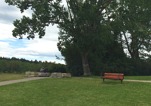
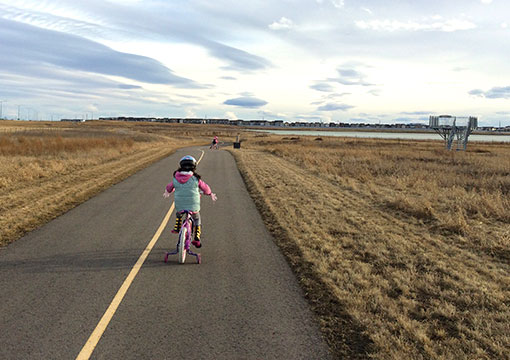
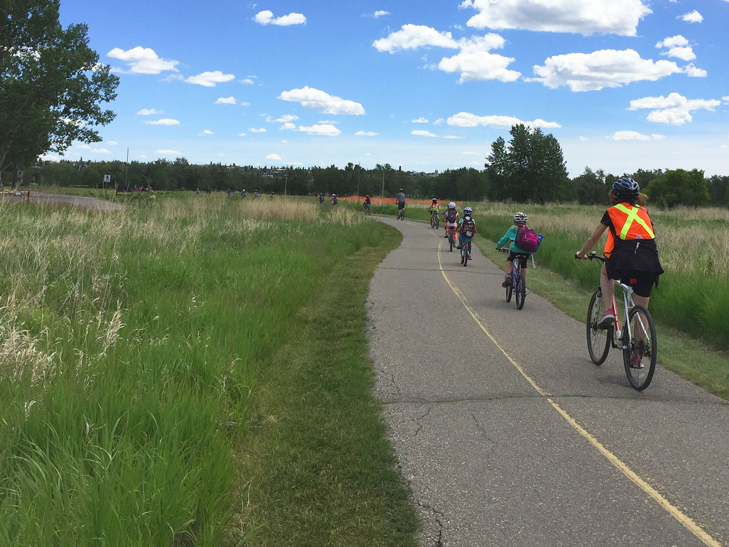
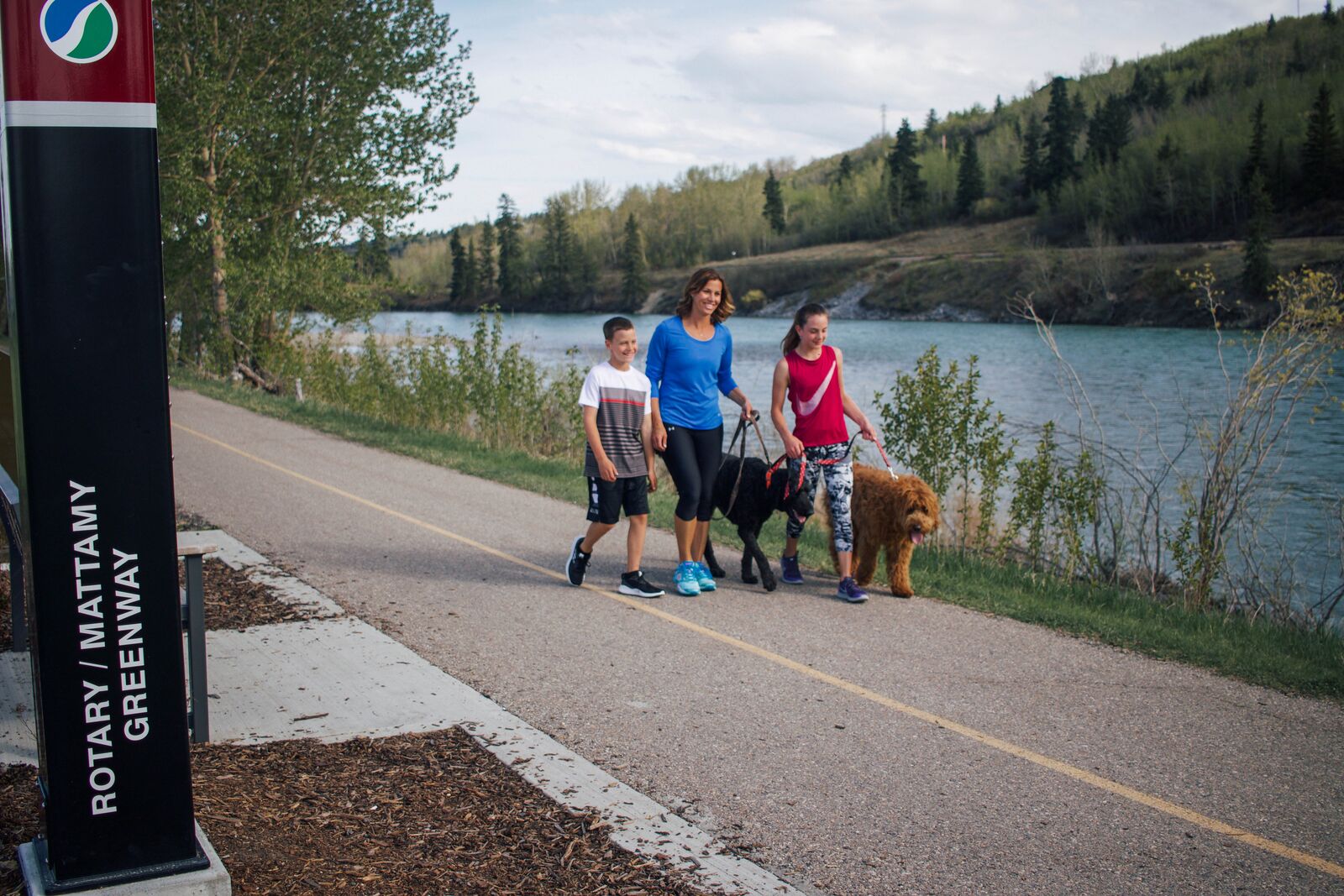
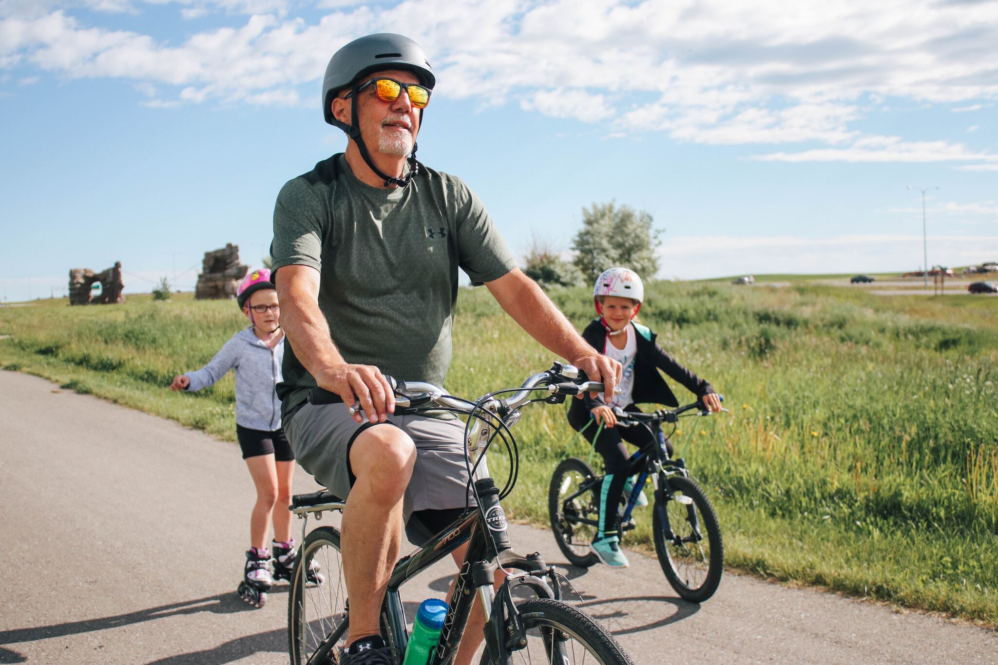
The Rotary/Mattamy Greenway links parks, natural areas, greenspaces, river valleys and citizens. The Rotary/Mattamy Greenway is a 145km urban pathway system that encircles the entire City of Calgary. This major pathway transportation network serves Calgarians by providing a connected system throughout 55 communities around Calgary and also connects with almost 1000km of existing pathways. The pathways can be used to commute to work or for free recreation activities all year round.
As a major urban pathway system, the Rotary/Mattamy Greenway is affected by multiple factors such as road and utility construction that can impact pathway connections.
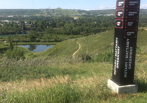
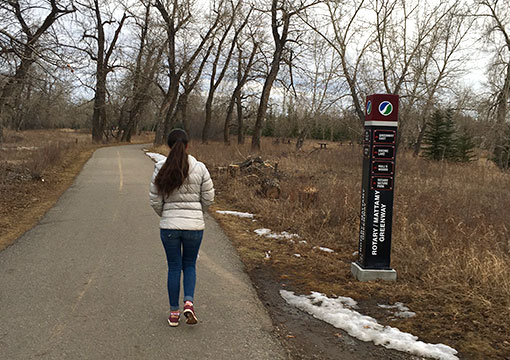
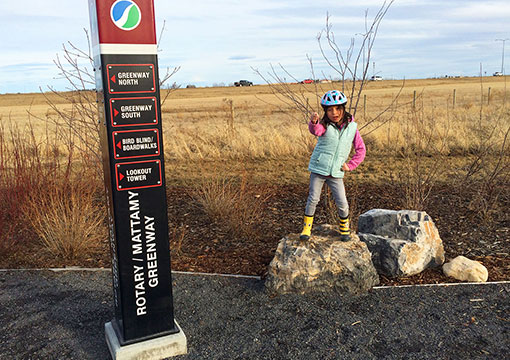
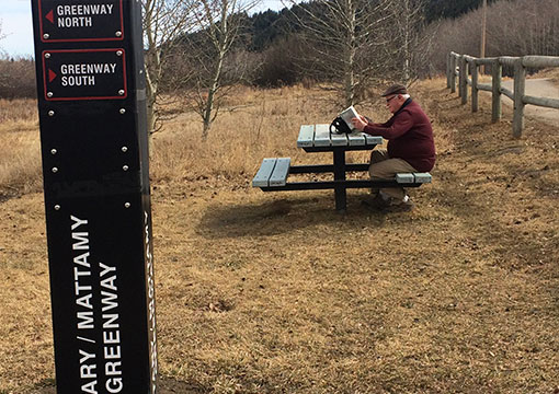
To navigate the Rotary/Mattamy Greenway you have to follow the posts and signs with the Rotary/Mattamy Greenway symbol.
You can follow the pathway using the City of Calgary's Pathways and Bikeways app CLICK HERE TO DOWNLOAD THE APP
You can also plan your trip ahead by using the City of Calgary's map.
CLICK HERE TO OPEN THE MAP AND SELECT THE TAB: PATHWAYS AND BIKEWAYS and follow the green line.
If you have any issues with the app or map, please contact 311.
POPULAR ROUTES
ALONG THE WAY!
THE CRANSTON RIDGE PATHWAY
RATING: EASY
Unless you’re from the southeast, you probably aren’t aware of the Cranston Ridge Pathway. This short route is only 2kms each way, a total of 4kms; it is quite flat so it makes for an easy and scenic walk/run. Plus, if you start/end at the Cranston Market shopping centre, you can come back to a treat of a slurpee, iced coffee or even lunch at the local public house!START/END: You can park in Cranston Market parking lot on 356 Cranston Rd SE and then head west on the path. There is only one intersection to cross so this route is very safe for children. As you’re heading west you will start to go down a hill, make sure to veer to the right at the Greenway sign or you will head further down the hill. At this point you will be along the ridge that has striking views of the Bow River below and the Greenway will continue for approximately another 1.5kms. There are plenty of benches to rest and enjoy the view. Turn around when the Greenway starts to go down hill in the direction of Rotary Nature Park of whenever you feel ready!
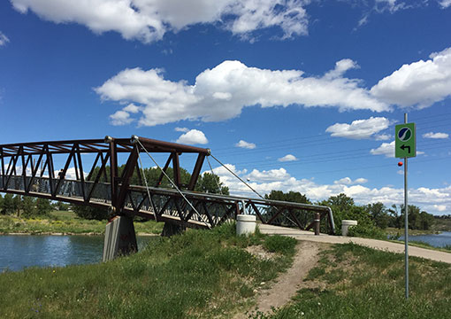
MAKE IT MORE DIFFICULT! At about the 2 km mark, the pathway will split. If you want to continue and make your journey more difficult, follow the Greenway sign in the direction of Rotary Nature Park and continue down the hill. This will bring you to the pathways adjacent to the river and you continue to the Bow River Pedestrian Bridge if you wish – you can also stop in Rotary Nature Park to test our your bird identification skills. This round trip route will be approximately 12.5kms. But remember, you have to come back up the Cranston Ridge Hill which is fairly steep so feel free to turn back at any time!
THE NORTHEAST PATHWAYS
RATING: EASY
If you are a biker that likes long, easy rides - perhaps you have an aversion to hills - then this is the route for you! As this part of the Greenway is on the east side of the city it is much less hilly than some of the pathways in the west or the south. This is one of the longest uninterrupted pathways on the entire Greenway system that literally goes on for miles without many pedestrian crossings. The reason that we can achieve this extended length of pathway is because it is located on the grassland adjacent to Stoney Trail. This route can go upwards of 30kms with only 2 pedestrian crossings each way, 4 in total. If you’re looking to build some stamina or are a beginner rider, keep reading…START/END: As with all the Greenway paths you can start pretty much anywhere but here’s our suggestions for a starting point. To start from the north you can park at the Saddleridge Elementary School, 368 Saddlecrest Blvd NE, and look for the Greenway sign to the Northwest. From here the path will turn to head south where it will be just over 6kms to get to McKnight Blvd.
MAKE IT MORE DIFFICULT! Cross McKnight Blvd. and go for another 4.5kms to 16th Avenue NE. Once you reach 16th Ave it will be a total of 21kms round trip. Turn back here or… keep going…?
TIP: There’s a shopping centre here, good place to stop for a drink and/or snack. Also there is ample parking, this could make a good start/end point if it is more convenient.
Continuing South Cross on the Greenway from 16th Ave NE to 17th Ave SE will add an additional 4.3kms each way. Total distance from Saddleridge to 17th Ave is approximately 30kms round trip, only 2 intersections to cross each way. TIP: When you get to 17th Ave SE, there is a Tim Horton’s!
WEASELHEAD TO ANDERSON
RATING: INTERMEDIATE
DISTANCE: 7.5km
For those who havent been to the Weaslehead, it is a beautiful natural area on the west side of the Glenmore Resevoir. This route has a couple of steep hills as you enter and leave the Weaslehead Natural area but once you pass through South Glenmore Park it is fairly flat.Start at the North Glemore Park parking lot, 6615 37 St SW, and head down hill into the Weaslehead. You will head up a hill on the south side of the Weaselhead and at the top you will turn right to head south on the Greenway.
Make it more difficult: You can keep going past Anderson but keep in mind there is a city detour due to ring road construction, it should be well marked as a pathway detour. This part of the Greenway will lead you to the paths in Fish Creek Park where you can continue for a minimum of 12kms more if you like. Turn around when you are ready!
Tip: If you are doing the round trip, bring a picnic lunch and stop atfer doing your preferred length of route and rest on the banks of the Elbow River. It is a beautiful location for a picnic and a great reward after your ride/run!
Transit Tip: If you decide to head into Fish Creek Park to MacLead Trail, there is the Fish Creek LRT station where you can end your journey. Keep in mind this will add about 8 more kms to your trip so plan accordingly!
BOWMONT TO BAKER
RATING: INTERMEDIATE/DIFFICULT
6kms one way – 12kms round trip.If you would like a challenging route with rolling hills and spectacular views, this will be the section for you! This route goes through the beautiful Bowmont Park and finishes at Baker Park. Start at the small parking lot at 2078 52 St NW and head north. Follow the Greenway signs along the ridge. It a fairly straight forward route but keep an eye out for signs around the pond and refer to the map (see yellow area). There are many paths in the area so it’s easy to get off route.
TIP: This route can be easily reversed by starting at the Baker Park parking lot and proceeding in the southeast direction.
make it more difficult: Keep going!! The pathway continues past Baker Park and heads towards Tuscany. Keep in mind there is quite a big hill that heads up to the community of Tuscany beside the Home Depot. Turn around when you are getting tired.
GREENWAY 150KM
RATING: DIFFICULT
75kms one way – 150kms round trip.This route is only for the ultra ambitious, but if you really want to challenge yourself, try this! This route also highlights some of the most beautiful scenic areas of the Greenway and of Calgary. These include 12 Mile Coullee, Baker Park, Bowmont Park, Edworthy Park, The Weaselhead, Fish Creek Park and The Greenway’s SE Crescent Point Energy Interpretative Wetland Boardwalks. This is a great way to challenge yourself while appreciating the beauty of Calgary and this small portion of our great country.
TIP: If you start at the Crowfoot Station and end at Ralph Klein, there will be a net loss in altitude of over 600ft that may make it ‘slightly’ easier. The other way around will be a net gain in altitude.
START/END: You can start either at Ralph Klein Park, 12350 84 SE and park in the parking lot OR you can take transit to the Crowfoot LRT Station.
Transit Tip: You can take advantage of the two LRT stations along this section of the Greenway, Crowfoot Station and Fish Creek Station.The distance between train stations is approximately 45kms so please plan accordingly. You could choose to split the challenge into three days by completing this route three times. Completing the challenge in three days is still very impressive!
AMENITIES ALONG
THE ROTARY/MATTAMY
GREENWAY
CITYSCAPE INTERPRETIVE WETLAND / MUSIC PARK & PLAYGROUND
Cityscape Music Park (Music Playground) was installed by Mattamy Homes near the wetland and the seating node. Educational signage make the visit interactive and generate a learning opportunity for everyone!TARADALE DOG PARK
This fully fenced dog park with parking lot is located on the east end of 64th Ave NE. It provides amenities such as weave poles, benches and granular paths creating the perfect time out setting to goof around.CN RAIL PLAYPARK
Beside the community of Applewood, this nature inspired playground has many boulders for climbing. A playpark to fully develop creativity and have fun.TRANSCANADA OUTDOOR FITNESS PARK AND MAHOGANY WETLANDS
An adult fitness equipment with large boulders and a ropes climbing course, surrounded by paths and viewpoints over the wetlands.ROTARY NATURE PARK
Granular pathways around engineered wetlands and the Bow River used for walking and observing local birds. Perfect for a natural escape.TOURMALINE OUTDOOR FITNESS PARK IN POINT MCKAY
This park contains 9 pieces of Norwell Outdoor Fitness Equipment that were designed for a full body workout. It also has a bike ‘fix-it” station that contains multiple tools to allow the user to fix their bike on site, it even includes a bike air pump!DAVID RICHARDSON MEMORIAL DISC GOLF PARK
The park is an 18 hole, tournament level course free-of-charge to all Calgarians. The 27-acre site is marked by rolling topography with numerous elevation changes, and includes spectacular views of the city and Rocky Mountains.CARRINGTON GREENWAY PARK & PLAY
This high-quality public open space combines active and passive uses for the surrounding communities.MANMEET SINGH BHULLAR PARK
The park encompasses over five hectares, featuring a gathering plaza and distinctive harvest tables that seat up to 20 people. Harvest tables were traditionally used to host feasts after the crops had been brought in from the fields. There are five diverse and separate groves of trees and five giant steel archways that merge into a natural space.SADDLEBROOK PLAYPARK
This nature inspired playground has many boulders for climbing, making it the perfect spot for adventures.BAKER PARK
This scenic manicured park developed by the City of Calgary overlooks the Bow River and Bowness Park on the opposite bank. It’s also home of an 18 hole disc golf course.ARC RESOURCES INTERPRETIVE WETLAND
This Wetland boardwalk with benches is one of the most scenic spots on the Rotary/Mattamy Greenway. Perfect to relax and enjoy nature or have a fun picnic with awesome view.CRESCENT POINT ENERGY INTERPRETIVE WETLAND
North of the Community of Copperfield there are three interpretive wetlands. The Rotary/Mattamy Greenway winds its way through natural grasslands to a series of boardwalks that traverses wetland areas leading to 2 bird blinds and an observation tower for viewing some of our regions most beautiful migratory, songbirds and waterfowl. Educational wetland signage has been installed to make the journey a learning experience. In total, this portion of the Rotary/Mattamy Greenway is nearly 5KM long with resting nodes with benches along the way.PEMBINA PIPELINES - BIRD TOWER On the southern end of the Southeast Interpretive Wetland is an elevated viewing tower. An amazing place to survey the entire wetland area complete with a sweeping view of the city all set against the backdrop of the Canadian Rockies.
CANADIAN NATURAL RESOURCES - BIRD BLIND AND BOARDWALK At the heart of the Southeast Interpretive Wetland area are a series of boardwalks and a bird blind that help you get up close to Southern Alberta's wetland ecosystem. Perfect for spotting amphibians, waterfowl or maybe even a rare sighting of various migratory birds who make a pit stop here.
CRESCENT POINT ENERGY - BIRD BLIND AND BOARDWALK Located at the northernmost stretch of the Southeast Interpretive Wetland you'll find a bird blind perfect for spotting nesting songbirds, small mammals and raptors like owls and hawks. The boardwalk here crosses seasonal marshlands.JIM DAVIDSON BARK N' PLAY DOG PARK
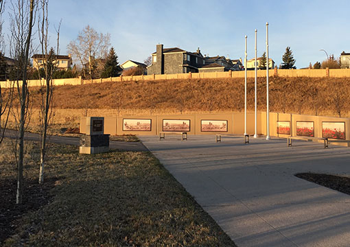
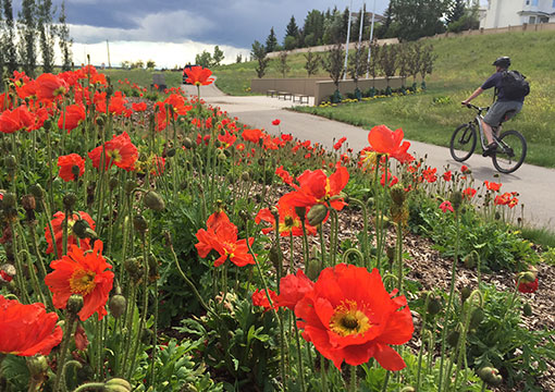
This fully fenced dog park with 2 separate fenced training areas includes weave poles and agility runs, as well as and pits for digging and a dog water fountain. It also has a granular trail system for pet owners.PETRONAS VETERANS MEMORIAL GARDEN
This garden contains over 9000 volunteer planted poppies and symbolic graphic panels depicting a World War I Army Regiment and a field of red poppies. The amenity was designed as a place for reflection that allows for quiet pride for those who have served our country and continue to fight for our freedom. It is located Just north of the Signal Hill Shopping Centre.BAKER PARK
This scenic manicured park developed by the City of Calgary overlooks the Bow River and Bowness Park on the opposite bank. It’s also home of an 18 hole disc golf course.